
Wild Rivers Coast – OR Sightseeing
Due to COVID-19, it’s recommended that you check website information to review any changes or conditions that may effect your visit.
Wild Rivers Coast – OR Sightseeing
Brookings

Brookings-Harbor, the Southernmost Community in Curry County, Oregon is located 6 miles north of the California border on Hwy 101. This is an area of abundant natural attractions with miles of coastline, wild scenic rivers, state and city parks, and an attractive port. The cities of Brookings and Harbor are nestled on either side of the Chetco River where it meets the sea. Brookings is an incorporated city, while Harbor is not. They are in an area often referred to as the “banana belt” of the Pacific Northwest, thanks to its sunny and temperate year-round climate. This makes Brookings a welcome reprieve for travelers in a region otherwise known for rain and fog. Highway 101 runs through Brookings’ commercial core, which can fill virtually any need a traveler may have. Over 90 percent of America’s Easter lilies are grown between Brookings-Harbor and Smith River to the south, and an early summer drive between Brookings-Harbor and Crescent City takes you through breathtaking views of fields of blooming lilies.
Activities in the Area
- Fishing, hiking, swimming, picnicking, boating, camping, wildlife viewing
- Brookings-Harbor boardwalk
- Recreational beaches and parks
- Salmon Run Golf and Wilderness Preserve
- Chetco Valley Historical Museum
MORE INFO: PortOfBrookingsHarbor.com, BrookingsHarborChamber.com
Samuel H. Boardman State Scenic Corridor

Arch Rock
Positioned roughly halfway between Gold Beach and Brookings, Arch Rock is the most well-known and easily viewed of the wave-cut natural arches and “bridges” in the Samuel Boardman Scenic Corridor. The squat, flat-topped formation is about 500 feet offshore and lies next to another small island. Extending to the north are a series of sea stacks that make up Mack’s Reef, a part of the Oregon Coast National Wildlife Preserve. Arch Rock is best viewed from the end of a short trail from the parking lot at the milepost 344.6 turnoff. The walk takes you through a meadow brightened by dazzling wildflowers in the spring. The trail also connects with the Oregon Coast Trail, a favorite with day hikers. The Arch Rock Picnic Area is wheelchair accessible, and has a public toilet. There is no day use fee.
WHERE: About halfway between Gold Beach and Brookings. Turn off Hwy 101 at the 344.6 milepost.
MORE INFO: 800-551-6949, 541-469-0224, StateParks.Oregon.gov
Natural Bridges & Thunder Rock Cove

Take the turnoff at milepost 346 to visit Natural Bridges, one of the most popular viewpoints in the entire scenic corridor. A wooden viewing platform, easily reached by a short trail from the parking area, overlooks a wave-cut natural bridge rock formation where you can watch the surf crash through the arches. Lesser trails branch off and descend more steeply to afford closer views of the natural bridges. The main trail connects to the Thunder Cove Loop, part of the Oregon Coastal Trail, after a quarter of a mile. That trailhead can also be accessed at the milepost 345.8 pulloff. The loop itself is a mile long, and descends steadily but not too steeply. It is well-maintained. The view is dramatic, but visitors should be careful and keep a close eye on children and pets, because the trail runs along the edge of dizzying drops in places.
WHERE: About 10 miles north of Brookings. Turn off Hwy 101 at the 346 milepost.
MORE INFO: 800-551-6949, 541-469-0224, StateParks.Oregon.gov
Harris Beach State Park & Chetco Point Park

Brookings is home to several beautiful beaches. Take an afternoon to explore them, picnic or walk the adjacent trails. Some of these beaches boast a treasure trove of shells and stones, while others provide a glimpse into marine life through tide pools. Camping accommodations can also be found.
Harris Beach State Park, on the north side of Brookings, has an exceptional rocky coastline dotted by monolithic sea stacks and bordered by gorgeous spruce, fir and pine trees. Sea lions, sea birds and seals are a common sight along the beaches, and in winter and spring you may see migrating gray whales. Bird Island, just offshore, is the largest island off the Oregon Coast and is a National Wildlife Sanctuary and breeding site for rare birds, including the tufted puffin. The park offers RV hookups, showers, restrooms, tent sites, Wi-Fi access, playgrounds, and cabins, yurts and teepees. Interpretive events, tours and educational programs are all available.
MORE INFO: 800-551-6949, StateParks.Oregon.gov
Chetco Point Park is a nine-acre beach park located half a mile west of Brookings, off Wharf St. The park features a large play area with lush rye grass, picnic tables and horseshoe pits. If you follow the walking trail south, both Chetco and Mill Beaches at the end of the trail contain a rich supply of shells, stones, marine life and ever-changing views of the power of the sea.
MORE INFO: 541-469-1103, Brookings.or.us/facilities/facility/details/Chetco-Point-Park-6
Azalea City Park
In Azalea City Park you can walk among ancient native azaleas that were growing when Lewis and Clark wintered on the Oregon Coast in 1805-06. Follow the numerous trails through this 33-acre park past astonishing endangered azaleas, annuals, shrubs and through stands of enormous trees. The paths are originally part of a pack trail that was used by miners in the 1850s. This was an important segment of the coastal wagon route leading from California to the Umpqua and Willamette Valleys in Oregon.
The park was dedicated in 1939, and the first Azalea Festival was held here. In recent years volunteers have revitalized the park and built walkways, a play area in the northwest corner of the park called “Kidtown” that provides younger children with a chance to play among forts, bridges, slides, tires and ropes, and a “Stage Under the Stars” band shell that hosts the annual American Music Festival, a free summer concert series.
MORE INFO: 541-469-1157, 541-469-1102, www.brookings.or.us/Facilities/Facility/Details/Azalea-Park-5
The Chetco River
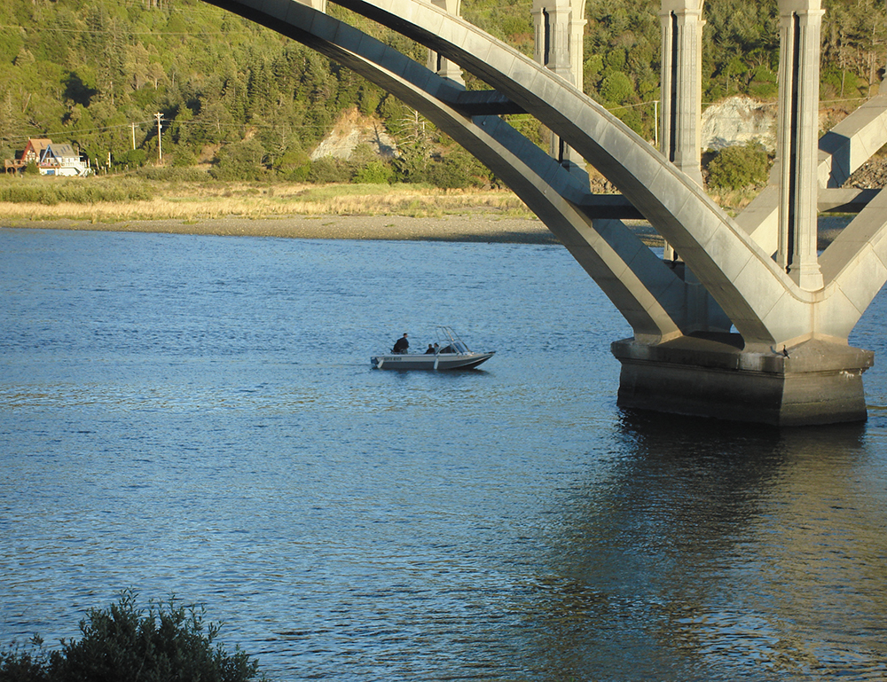
To see the rugged and wild side of nature, take a trip along the 55-mile long Chetco River. The upper 45 miles of the river, from its headwaters to the Rogue River-Siskiyou National Forest boundary, have been given the federal designation of Wild and Scenic river, with the last 9.5 miles from Eagle Creek a recreational segment. In the summer, visitors love to go fishing, four-wheel driving, hiking, swimming, picnicking, rafting, kayaking, camping and wildlife-viewing on the river. In the winter, people partake of excellent salmon and steelhead fishing, and a few brave and hardy souls go white-water kayaking. At its headwaters in the Kalmiopsis Wilderness, the mountainous terrain is steep, sparsely vegetated and deeply dissected; the river floor is narrow and boulder-strewn, with many rapids and falls. Leaving the wilderness, the river begins to widen but still narrows at points, crossing through rocky outcroppings where it leaves behind gigantic boulders. The dramatic Chetco River Gorge, with its abrupt sides and unique rock formations, is well worth a visit. Below it, the river continues to broaden with sandbars and raised river terraces. The river eventually empties into the Pacific Ocean between Brookings and Harbor, just five miles north of the California border, where it is gentler, the river bottom wider and its banks covered by dense forest. Along its journey it drops 3,700 feet in elevation.
WHERE: The Chetco River winds through the southern part of Curry County and can be found by going to the Kalmiopsis Wilderness in Siskiyou National Forest or driving along North Bank Chetco River Rd. off Hwy 101 near Brookings.
MORE INFO: 541-618-2200, www.fs.usda.gov/recarea/rogue-siskiyou/recarea/?recid=74289
Port of Brookings-Harbor

The Port of Brookings-Harbor shines like a jewel on the beautiful Siskiyou Coast in Southern Oregon. Located just over the border from California and the Redwood National Forest, the Port of Brookings-Harbor is the gateway port to Oregon. With Oregon’s safest bar and a temperate climate (temperatures of 70 degrees not uncommon in July or January), the Port offers an ideal site for both the serious deep-sea fisherman and the person who has never tried his hand at catching the big ones, as well as those whose favorite pastimes reside on terra firma.
Off the water, the Port contains an array of retail businesses fronting an impressive boardwalk that overlooks two boat basins. The Boardwalk, a great source of local pride, provides a beautiful, restful place for locals and visitors alike. It is lined with colorful shops and businesses offering a wide array of merchandise and services: books, ice cream, clothing, artwork, guided tours, and a spectacular diversity of mementos and gifts. Restaurants in the area feature everything from snacks to regional and international cuisine, including, of course, fantastic seafood.
The Port of Brookings-Harbor enjoys easy access from Hwy 101. From the South (California) a left-hand turn at the Benham Ln. traffic light leads the driver onto Lower Harbor Rd. and the southern end of the Port area. From the North, Hwy 101 signage is limited, but does allow traffic to exit to Port property. The bridge crossing at the Chetco River allows an adequate view of the Port to alert visitors of the approaching exit. The Port can also be accessed from Shopping Center Ave., and from Benham Ln. via Oceanview Dr.
MORE INFO: 541-469-2218, PortOfBrookingsHarbor.com
Fishing in Brookings
Fishermen love Brookings. The area, known for its warm, mild climate and natural beauty, offers superb year-round ocean and seasonal river fishing. The Port of Brookings-Harbor has one of the safest entries to the Pacific Ocean on the West Coast. It is a working port that caters to sport fishermen, sailors, pleasure boaters, and a fleet of commercial fishing vessels. The supporting infrastructure provides dock, electrical, fuel and sewer services. Numerous ocean-going boats are available for charter. Sportsmen may try their hand at bottom fishing (lingcod and a variety of rockfish such as rock cod and Pacific snapper) or go after salmon, halibut, albacore, red tail perch, Dungeness crab or shark. For the more laid-back, fishing from shore is another option. River fishing is also a popular pastime in and around Brookings. The Chetco River, which flows into the Port of Brookings-Harbor, and the Winchuck River to the south, both receive rave reviews for their salmon, steelhead, and cutthroat trout populations.
MORE INFO: 541-469-2218, PortOfBrookingsHarbor.com
Gold Beach

Discover Nature’s “Wild Side” in Gold Beach. Escape to uncrowded beaches, pristine wide-open spaces, incredible hiking trails, vast forests and rugged mountains. Located in Oregon’s “Banana Belt,” Gold Beach has more sun hours than any other town on the Oregon or Washington coasts. This peaceful but activity-rich community rests on the banks of the Rogue River where it flows into the Pacific Ocean, and has become known as “Nature’s Adventure Center.”
Activities in the Area
Gold Beach area activities include beachcombing, tidepooling, clamming and crabbing, photography, nature walks and wildlife and bird-watching. Gold Beach is highly rated for windsurfing and Stand Up Paddle Boarding, and is considered one of the Northwest’s choice bases for whitewater jet boating, kayaking and biking. It is probably best known for exciting jet boat tours up the Rogue River.
- The Rogue River is famous for world-class salmon and steelhead fishing; professional guides are available.
- There is excellent ocean fishing out of Gold Beach. Charter trips are available at the Port of Gold Beach. Lingcod, snapper and other rock fish are all caught locally.
- Horseback riding on the area’s scenic beaches and through the coastal mountains.
- Hikers have many trails to choose from. The Oregon Coast Trail both south and north of Gold Beach is spectacular. Inland trails include the Rogue River Walk, Shrader Old Growth Trail and the Myrtlewood Trail.
- Whale-watching and winter storm-watching.
Hiking & Biking Trails Near Gold Beach
Some of the most majestic sights of coastal Oregon are the enormous old Douglas firs. Schrader Old Growth Trail is an easy hike and home to some of the oldest trees in the area. Bring your mountain bike and ride the trails. Make sure you keep your eyes peeled for the wildlife that inhabits the forest around these 300-year-old trees. This interpretive trail is a one-mile loop. Pick up a brochure at the trailhead and learn about the different plants and animals that you might see along the way. After you have looped around the Shrader Old Growth Trail, you can cross the Lobster Creek Bridge and head to the Myrtle Tree Trail. Since this trail is much shorter, about a quarter mile, you might want to try it out first. The largest myrtle tree in the world can be found on this trail. This stately myrtle stands at nearly 90 feet tall and 42 feet around. These two trails offer excellent, short hikes for those looking to enjoy the outdoors. The Myrtle Tree and Shrader Old Growth Trails are located on either side of the Lobster Creek Bridge. To get to the bridge, follow the signs at Jerry’s Flat Rd.
MORE INFO: Gold Beach Visitor Center, 800-525-2334, VisitGoldBeach.com
Pistol River State Park
Pistol River State Park was the site of a fierce battle in the Rogue River Indian Wars of the 1850s, but today is known primarily for its beauty, its flora and fauna and the many recreational opportunities it offers. The Pistol River carves its way past fantastic rock formations, between towering sand dunes and finally into the ocean. It has repeatedly changed its course, and left behind unique pothole ponds that provide waterfowl with ideal habitats, making the area very popular with bird-watchers. The park also offers superb windsurfing, with conditions so ideal that the national windsurfing championships have been held there. Walking, swimming, hiking and boating are among the many recreational activities popular at the park. Interpretive tours are offered and you are almost guaranteed to see abundant land and sea wildlife, including a wide variety of the birds who make the park their home. A horse trail is maintained there as well.
WHERE: About 11 miles south of Gold Beach just off Hwy 101.
MORE INFO: 800-551-6949, OregonStateParks.org/park_76.php
Pistol River Wave Bash
Every June some of the world’s best windsurfers come to Gold Beach for a high-powered tournament known as the Pistol River Wave Bash, a major event on the American Windsurfing Tour (AWT). It’s held in the surf off Myers Beach in Pistol River State Park, just south of Gold Beach. The naturally occurring combination of wind and surf here make this area one of the world’s premier locations for this unbelievably exciting sport, and the dazzling natural beauty of the surroundings makes it absolutely perfect. The event attracts champions from all over the U.S., the South Pacific, South America, Europe and the rest of the world.
WHERE: About 11 miles south of Gold Beach just off Hwy 101.
MORE INFO: AmericanWindsurfingTour.com
Gold Beach Treasure Hunting

February through April is Treasure Hunting Season in Gold Beach! Each year thousands of colorful glass floats are “hidden” on the beach for visitors to find. Every week the floats are placed above the high surf line on the beach from just south of Kissing Rock wayside to a little north of the Rogue River north jetty (approximately 3 miles of beach). During the week of Valentine’s Day, only red floats are put out. Visitors who find a glass float get to keep it, plus they also get to enter a monthly drawing at the Gold Beach Visitor Center. One lucky winner is chosen each month for a vacation package valued at over $300.
Select local retailers also participate in the treasure hunting. Spend at least $25 in one of the stores and take your receipt to the Visitor Center to receive a glass float and be entered in the special retailers’ monthly prize drawing.
MORE INFO: 800-525-2334 or 541-247-7526, VisitGoldBeach.com
Fishing the Lower Rogue & the Oregon Coast
Gold Beach offers not just world-class fishing year-round, but it offers the best of both worlds. From here you can fish the world-famous Rogue River, or you can enjoy fishing the waters of the Pacific Ocean off the Southern Oregon coast — or do both!
There is nothing like watching the spectacular views of sunrise or sunset over the ocean and mountains as you enjoy calm water fishing on the Rogue River in the Gold Beach area. Spring Chinook (or king) salmon are caught between Gold Beach and Agness (2 to 35 miles upriver). Similar to fall Chinook, these “springers” are in peak physical condition as they leave the cold waters of the Pacific and come into the Rogue system in search of their spawning grounds during springtime. Known for their mouthwatering flavor, spring Chinook range in size from 10 to 40+ pounds.
In summer and fall you can troll the Rogue River Bay for fall Chinook salmon that, once hooked, give even the most experienced angler a challenging fight. These fine fish also range from 10 to 40+ pounds. In fact, one weighing over 70 pounds was landed by a fisherman several years ago. Summer steelhead (or half-pounders) also provide excellent fishing during these months.
December through March is a favorite time of the year for many locals because Gold Beach typically has multiple days of sunny, mild weather during this period. Steelhead fishing reaches its peak in February, with opportunities to cast in as many as five rivers within a five-minute to one-hour drive from the center of town. How does a covered, heated 21-foot powerboat sound? Or an open drift boat with heater? These vessels carry two to four people, depending on conditions and fishing method. Guides, boats, licenses and tackle are all available in Gold Beach. If you are not boating, you can also drive upstream. Locals can point out many public river access spots for good fishing.
The ocean is, of course, a different kettle of fish altogether, with a variety of fish available throughout the year. Gold Beach offers the best ocean bottom fishing opportunities on the Oregon coast. Try your luck just a few miles offshore in 40 to 125 feet of water for a chance at great catches of excellent-eating seafood.
Cape Sebastian State Scenic Corridor
Cape Sebastian State Scenic Corridor offers gorgeous panoramic vistas. There are two parking areas that provide direct access to the overlooks. The first of them sits 200 feet above sea level and offers a view that can extend over 40 miles north. Humbug Mountain is a dominant part of this remarkable vista. The view to the south is even more amazing, spanning out for more than 50 miles toward St. George Lighthouse and Crescent City. Most of the park is covered by Sitka spruce. A 1.5-mile walking trail to the cape leads to a great spot for hikers and bird-watchers. Head down to the beach and enjoy the rolling waves and foaming waters of the Pacific Ocean. Enjoy fishing or watch for wildlife on land and in the water. During certain times of the year, the park becomes the perfect place on the Oregon Coast to watch enormous grey whales migrate either south for the winter or north for the summer.
WHERE: 7 miles south of Gold Beach, just off Hwy 101
MORE INFO: 800-551-6949, OregonStateParks.org/park_73.php
Cedar Bend Golf Course

Nestled between the mountains of beautiful Cedar Valley and graced by the clear waters of the Cedar Fork Creek, Cedar Bend Golf Course is a mentally engaging golfer’s destination on the Oregon coast. This nine-hole course has two flags on each green and dual tees, allowing it to also function as a par-72, 18 hole golf course. Golfers are challenged with the combination of elevated tees and greens, as well as water hazards throughout the course. The course provides a stimulating challenge for experienced golfers, but also plenty of forgiveness for those new to the game. Cedar Bend welcomes all levels of golfers from beginners to scratch. Cedar Bend Golf Course offers a fine clubhouse facility that houses a snack bar, barbecue pits, pro shop, and the “19th hole” — their friendly little bar. The clubhouse is available to groups or large parties for special events.
WHERE: 34391 Cedar Valley Rd., Gold Beach
MORE INFO: 541-247-6911, CedarBendGolf.com
Agness

At the crossroads of Hwy 101 and County Road 595 (better known as Jerry’s Flat Rd. in Gold Beach), try this: just go east instead of north. County Rd. 595 is the “road less traveled.” Follow the Rogue River up into the hills about 20 miles and the road turns into National Forest Development Rd. 33, also called Agness Rd. There is a photo opportunity around every turn, and the unspoiled beauty is breathtaking. Giant conifers line one side of the road and the legendary Rogue River is on the other. Keep following the Rogue about 15 miles to the small town of Agness, where the river runs right through the center of town. Agness is located where the Rogue National Wild and Scenic River area and the Illinois Wild and Scenic River area converge. The town has a “city” limits sign proclaiming “Pop: Small.” For a town its size it has so much to give. Spend some time with the locals and find out for yourself.
The 35-mile drive from Gold Beach to Agness is exceptionally scenic and enticing, and travelers will want to stop many times along the way. En route enjoy hiking, camping, fishing, rafting, jet skiing and kayaking… or just head straight to Agness to get away from it all. In September The Gathering of the People Pow Wow Festival is held in Agness.
Wild Rogue Wilderness
The Wild Rogue Wilderness is a prime example of the natural, scenic beauty that is seemingly everywhere in Southern Oregon. It was established as a wilderness area in 1978 to provide watershed protection for the federally designated “wild” portion of the Wild and Scenic Rogue River. This area, although accessible by car, lives up to its “wild” name. Nearly vertical cliffs and razor-sharp ridges provide a breathtaking backdrop for the pristine mountain creeks that ripple toward the rivers.
The region was originally settled by hunters and gold prospectors, who were drawn to the land by the prospect it held for wealth. Little gold was ever found in the area, but as you wander through you are likely to run across 150-year-old remnants of the search. Stamp mills, flumes and trestles still speckle this otherwise undeveloped tract of land. If you are a fisherman, you will be
delighted by the tremendous steelhead and salmon fishing. If you prefer pulse-pounding excitement, test the exquisite whitewater the Rogue River has to offer. Hikers love the National Recreation Trail that provides the only access year-round to the portion of
the Rogue from Graves Creek to Illahe. And it should be no surprise that the Wild Rogue Wilderness is a camper’s paradise.
MORE INFO: Gold Beach Ranger District, 541-247-3600
Rogue River Jet Boats
Ride with Jerry’s Rogue Jets and Mail Boat Trips to enjoy the most beautiful section of the Rogue River in comfort and safety. Set aside in 1968 as one of the original Wild and Scenic Rivers, the Rogue’s scenery and white water will amaze even the most seasoned travelers. Ready your camera to photograph deer, bear, osprey eagles, otters and other wildlife. Their experienced local river pilots will navigate rocky rapids and shallow waters in comfort while narrating the rich history and tall tales of the local settlers. All tours stop upriver for lunch or dinner before returning downriver to the docks at the Port of Gold Beach.
Roguejets Inc. operates under the authority of US Forest Service Special use permits for limited entry into this unique wilderness area.
WHERE: Jerry’s Rogue Jets is located a short distance from the mouth of the Rogue River in Gold Beach.
MORE INFO: 800-451-3645, RogueJets.com
Port Orford

The oldest established town site on the Oregon coast and the westernmost incorporated city in the lower 48 United States, Port Orford is a jewel-like coastal village perched on scenic bluffs about 30 miles north of Gold Beach. It is also an open-water port, with no bar to provide natural protection for moorage in the water. As a result, it’s become one of only a small handful of “dolly dock” ports in the world. Two giant cranes hoist fishing boats into and out of the water. On the dock they set the boats down on custom-made dollies (trailers) parked in rows.
Because there is no dangerous bar to cross, ocean sport fishermen enjoy more fishable days per year, and good fishing can be found just a few minutes from the dock. The Orford and Blanco reefs offer excellent bottom fishing. These waters are also popular among divers, and kayaking and windsurfing have become increasingly popular there as well. The absence of a bar also means outstanding
beachcombing.
MORE INFO: Port Orford Chamber of Commerce, 541-332-8055, PortOrford.org;
StateParks.Oregon.gov
Port Orford Heads State Park
& Battle Rock Park

Port Orford Heads State Park and Battle Rock Park are beautiful expanses of coastal land running along the western edge and the southeastern shore of Port Orford. Both are rich in natural beauty, recreational opportunities and historical significance.
Port Orford Heads State Park has excellent hiking trails on the headlands affording dramatic views up and down the Pacific Coast. In the park you’ll find the Port Orford Lifeboat Station, which has become a museum (admission is free). Four other historic buildings also remain on this site.
Battle Rock Park is named after a large rock extending from the northern end of the beach out into the ocean. It was the site of a fierce battle between crewmen from an old steam propeller vessel, the Sea Gull, and American Indians of the Qua-to-mah tribe in 1851. Today Battle Rock is where fireworks are set off for Port Orford’s annual 4th of July Jubilee.
MORE INFO:
Port Orford Heads State Park, 800-551-6949, StateParks.Oregon.gov;
Battle Rock Visitor Center, 541-332-4106
Cape Blanco State Park

Cape Blanco is located about 9 miles north of Port Orford along a mountainous stretch of Oregon coastline. Jutting out a mile and a half into the Pacific, it is a large and fairly level promontory about 200 feet above sea level, with white, chalky cliffs that face the ocean (hence its name) and jagged, rocky formations extending from its northern end. The Sixes River flows into the Pacific Ocean at the northern border of Cape Blanco State Park, and a short 2-mile hike along the Oregon Coast Trail leads south from the park to the mouth of the Wild and Scenic Elk River.
The cape’s two most notable landmarks are the Cape Blanco Lighthouse and Hughes House. The lighthouse went online in 1870 and is still in service today. It is open to the public from April through October, and the view of the coastline from the lens room is absolutely spectacular. The Hughes ranchhouse was built in 1898, and has been completely restored. It is on the National Register of Historic Places, and is now operated as a historic house museum. There is also a nearby pioneer cemetery.
There is a great campground with enormous, shaded campsites and amenities including water spigots, vault toilets and showers.
MORE INFO: 800-551-6949, 541-332-2973, StateParks.Oregon.gov/index.cfm?do=parkPage.dsp_parkPage&parkId=44